
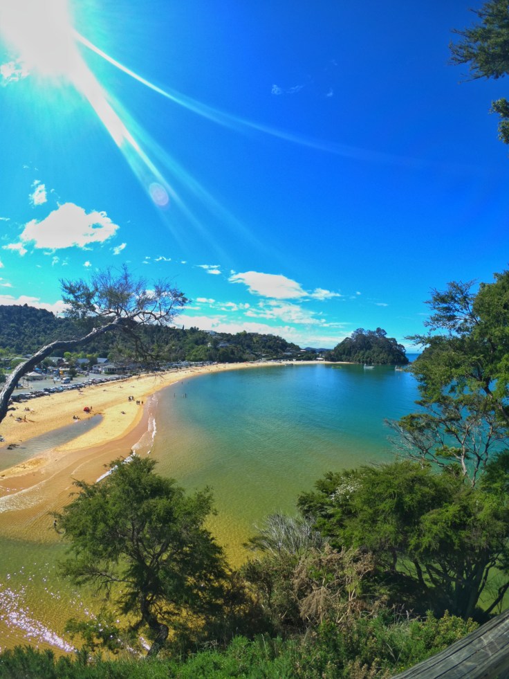
After the emptiness of the West Coast driving into Nelson and through the surrounding area was a stark contrast to the previous week. I was back to some kind of modern civilisation. I had heard a lot about the place before arriving, but still didn’t really know what to expect. Although whatever my preconceived expectations of the place were, on arrival it wasn’t what I’d imagined. I checked into a hostel I had been recommended, Paradiso, which has a pool, sauna, hot tub and just a chilled out sexy vibe (had to drop an Inbetweeners quote in one day). But again as with everywhere, it wasn’t too busy. I imagine in its prime or with a great group of people, it would have been great. Regardless of the current occupancy rate, it was still a nice place for a few nights stay. That evening I met up with a friend from Queenstown, Cian for a catch-up and a beer. We spoke about what we had been up to since leaving QT and what our future plans were. Cian had just started a new job which he hated, was contemplating packing it in and moving to Wellington. He was laying fibre optic cables, the same industry I had worked in while in Australia, so I could relate to him with what he was telling me. After a few drinks, we called it a night as Cian had to be up for work the following day. In the morning the weather was decent and the sun was shining. A welcome change to the rain and grey skies of the West Coast. I took a walk up to the Centre of NZ Monument, which is more a symbolic centre point of NZ as opposed to the true geographical middle. After this, I then drove out towards Cabel Bay. The name stems from the fact New Zealand’s first overseas cable link came ashore here from Australia, 21 February 1876. The international telegraph cable established a connection with the worldwide telegraph network via Sydney. That has since long gone but the bay itself was very pretty and an idyllic location for a few hours. I hiked up to the top of the hill which crossed sheep inhabited farmland and provided panoramic views. Once here I just admired the view for an hour or so. It also happened to be the 28th of October, so 3 years to the day since I had left home to commence my travels. I therefore, indulged in the solitude, taking some time to reflect on all that had happened the past 3 years and where I had now ended up. When I left home I had plans to a certain point but then life has just taken its own course. I’m very happy with how everything has turned out, not only the destination I’ve arrived at but also the journey to get here too. Both in a metaphorical and literal sense. I’ve learnt a lot about the world, myself and what I want to do with my life moving forward. Who knows what the next 3 years have in store. But I’m not worried as I know whatever happens I’ll make the most of it and live life to the fullest regardless of where I end up and what happens.
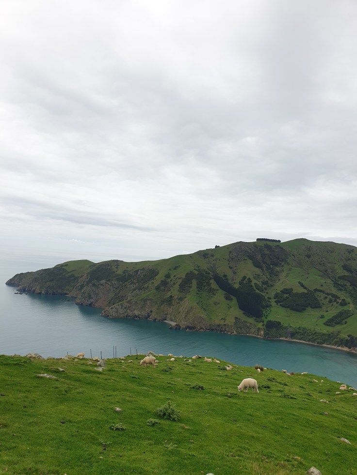
Cable Bay 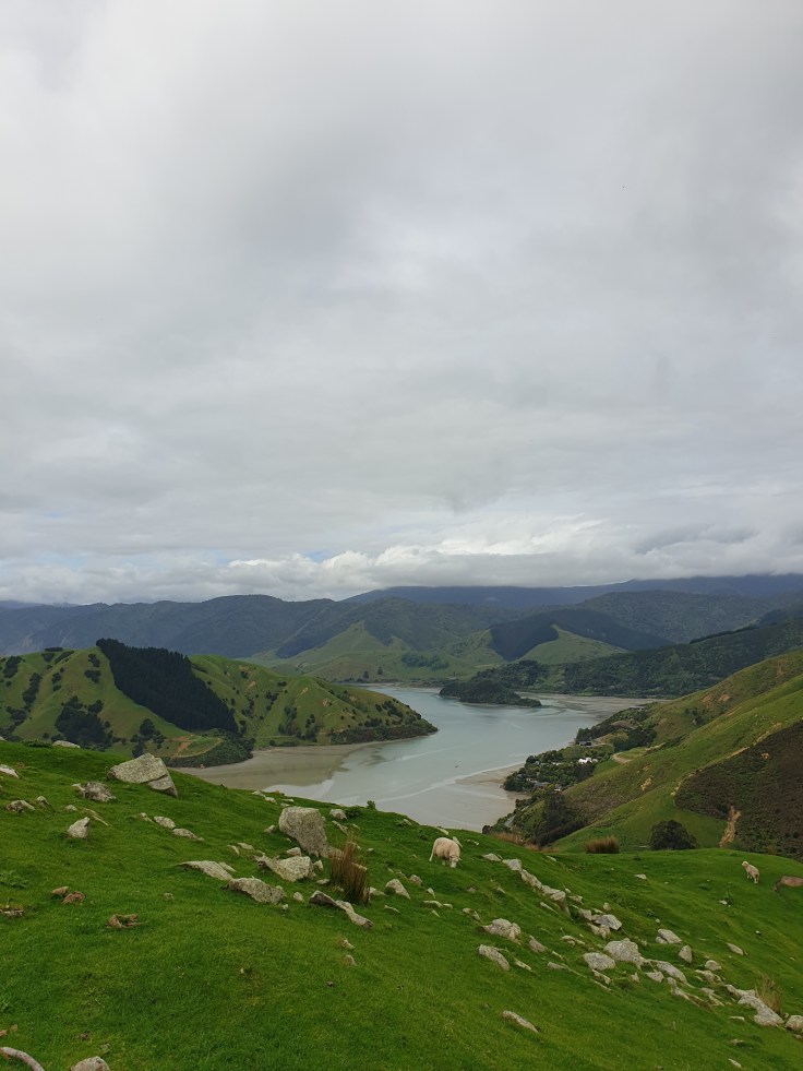
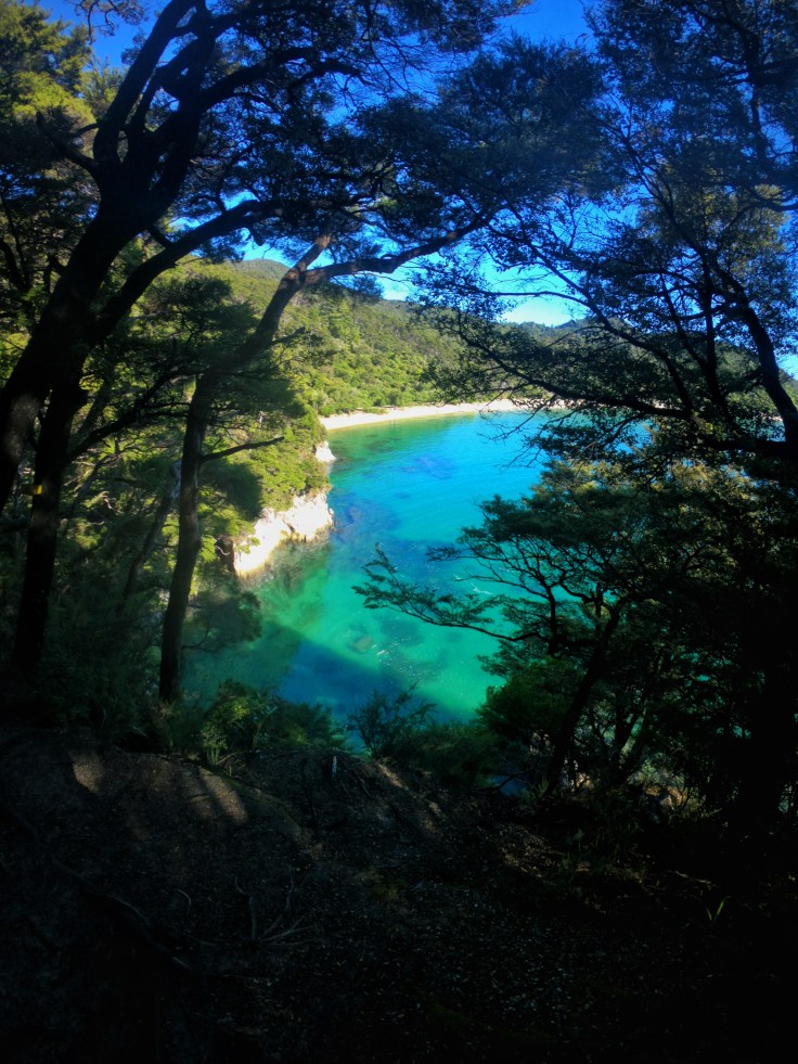
After a few days in Nelson, I then drove an hour west to Kaiteriteri (KT) where I had another friend from QT, Elgan that had recently moved there for work. He had secured a job at the holiday park and had his own staff cabin which I was able to crash in, free of charge. I arrived mid-morning, the weather was great and the beach was stunning. This was more what I had pictured Nelson to be like if I’m honest. After arriving and getting settled Elgan and I hired a kayak to paddle out to Split Apple Rock. Shaped like a giant Pacman and perched atop a bed of rocks, the story behind the rock is hotly contested. Scientists believe that the rock was split through a natural phenomenon known as ‘ice wedging’ during an ice age over 120 million years ago. As the temperature dropped, any water that had entered the cracks of the rock would have frozen, causing it to expand and split. On the other hand, traditional Māori legend claims the boulder was split in half when two feuding gods were fighting to possess it. To resolve the issue, they used their strength to split the rock in half, hence the Māori name for the rock Toka Ngawhā which means “burst open rock”. As well as circling the rock we also stopped at a few of the secluded beaches. Two-hour sea kayaking was certainly the best way to explore the beauty of the place.
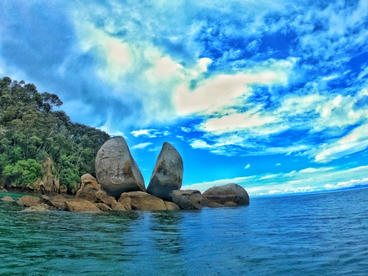
Split Apple Rock 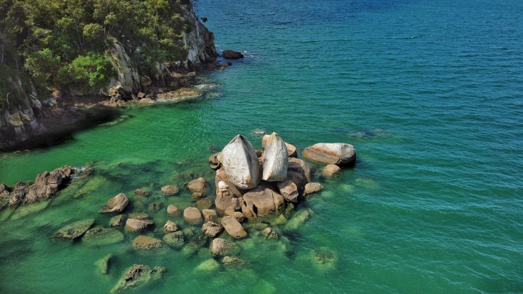
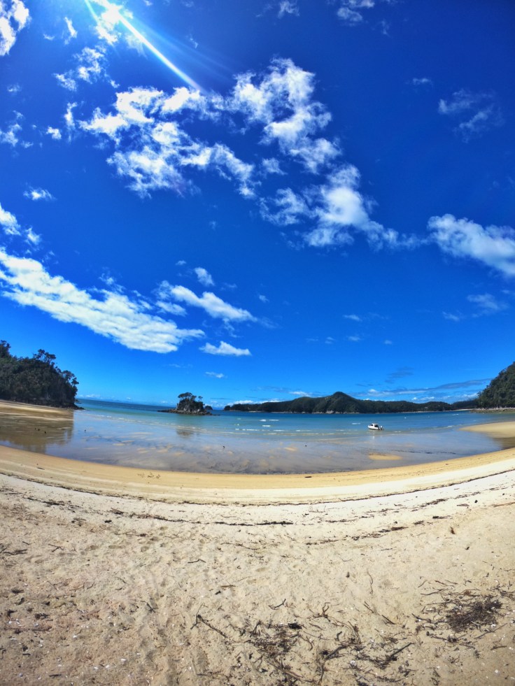
Split Apple Rock from the Drone
After the kayaking, we then decided to head to Takaka, which is an hours drive further on from KT. Over Takaka Hill, we booked ourselves a night at the local YHA, and on arrival commandeered two of the free bicycles and headed out for a ride. First stopping at Laberthin Rocks, where Elgan somehow managed to slip over and slice his hand open. His fault he was trying to sneak up on me, kind of gave himself up when I heard the thud and “Ouch”. But his injuries weren’t life-threatening so we continued on our cycle tour to Pohara Beach, another beautiful spot, with the beach sweeping around the whole bay and views of the distant Farewell Spit. After completing our cycle ride which lasted a few hours, we cooked some food at the hostel, then headed for a beer at the nearby Roots Bar. We only had the one before calling it a night seeing as it had been quite the active day what with the kayaking and cycling. Takaka is renowned for being the hippie, free spirit place of NZ, similar I guess to the reputation of Byron Bay in Australia for those who have been. Not quite on the same scale and stature but the comparison can still be drawn I feel. We had seen a yoga class advertise for the following morning so booked ourselves in, needing a good stretch after the previous day. It was a Hatha class, with Bay Yoga costing only $15 for an hour and a half. What a bargain. Having not attended a class since Sydney where I first attempted yoga, it was great to be back in a guided session. It was a great mix of some challenging poses, nice stretching and gentle savasana meditation. You always feel so relaxed after a class and once back into some kind of proper routine I’d like to get more involved with it again. After the peaceful morning, we drove back to KT as Elgan had work, which allowed me to just relax on the beach reading my book. I took a walk to the nearby lookout and then along little KT beach just around the bay.
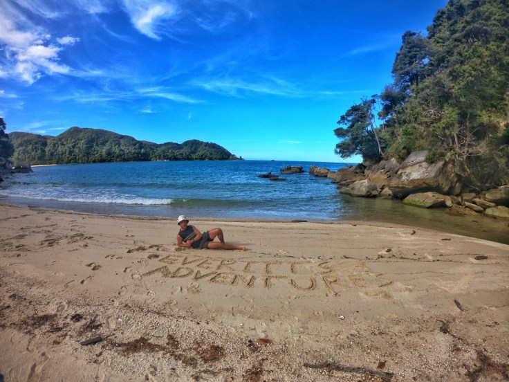
Kaiteriteri Recreational Reserve 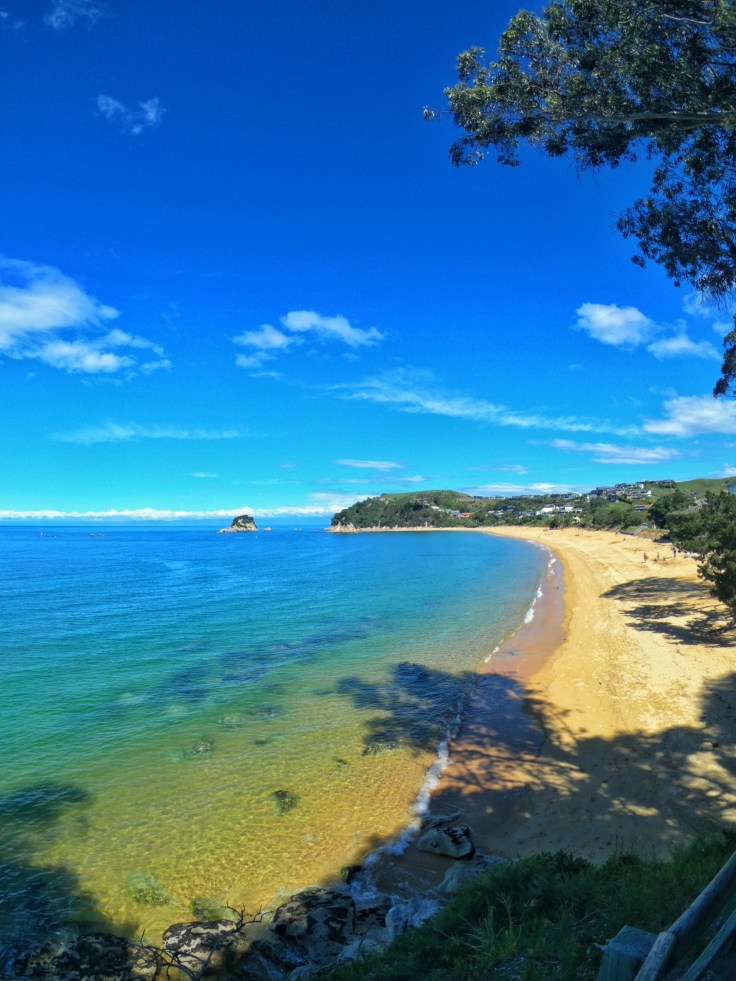
Little Kaiteriteri Beach
The following day Elgan again had work but we were also now joined by Cian, who had subsequently quit his job and had come to visit before heading over to Wellington. When he arrived we drove to Split Apple Rock, chilling on the beach and I also took my drone to try to get some pictures from the air. That evening we got ourselves organised in preparation for starting the Able Tasman walk the following day. The Able Tasman is another one of New Zealand Great Walks but very different to the ones I’ve completed so far. This time instead of being in an alpine/mountainous environment you follow along the coastline, hiking between various beaches along the shore. The length of the track is 60km meaning you would need 3 days to do it all. The plan though was for Elgan and Cian to join me for the first day and then get picked up by water Taxi at Bark Bay. I would then stay the night in the DOC hut at Bark Bay, before continuing on solo the next day to Totaranui where I would then be picked up myself. It would mean I’d miss the final 15km of the track, however, past this point the water taxis cease to operate. Meaning returning to the starting point would have been a more arduous process. Plus staying more than one night also requires a bit more preparation. I was happy with the plan though, it would provide me with ample opportunity to see most of the track, could enjoy it with some friends as well as have some time hiking alone.
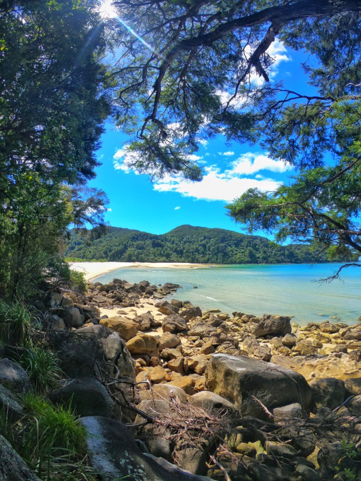
Day 1 started with the three of us driving out to Marahau where the track starts. We set off just before 9 am with the water taxi pick up for the lads scheduled at 3:30 pm. More than enough time to cover the 22km to Bark Bay. The weather was warm and sunny, with the odd cloud passing overhead throughout the day. Ideal hiking weather. The first leg of the hike took us from Marahau to Anchorage, which is a beautiful little bay home to a DOC hut if you wish to stay for the night. From Anchorage you then have to pass over the Torrent Bay Estuary, you are only able to do so a low tide, one of 3 such places on the track. If you fail to arrive at low tide, there is the option to take the high tide track which adds a few km to the trip. Thankfully for us, although more through luck than judgement, the tide was out. Meaning we crossed the estuary barefoot as there was still ankle depth residual water in some of the current dug trenches. Upon crossing the water we stopped to dry our feet and have a bite for lunch watching several ducks squabbling with one another. From Torrent Bay it’s then another few hours to Bark Bay, you weave your way inland and up over some of the coastal cliffs before descending back down to the coast, passing Medlands Beach before arriving at Bark Bay some 10 minutes later. Here you can again spend the night in a DOC hut or even camp at the beach. We arrived with a good hour to spare so chilled out on the beach before the water taxi came to collect the boys, leaving me to carry on solo tomorrow. That afternoon/evening I lazed around on the beach reading and took a stroll along the sand trying to get a few photos of the different birds. One particular species the Variable Oystercatcher, which is black and has a long bright orange bill were pretty prevalent on the sand. I started to get closer and closer to a pair who were squawking intently at me, not thinking too much of it I tried to inch closer to get a picture. It was at this moment I spotted their nest out the corner of my eye with a few eggs nestled there. Instantly I knew what all the fuss was about and they were, through no polite terms, telling me to “do one” in bird language as I was too close. It was at this point one of them then flew up and started to dive bomb me a few times as I legged it off down the beach away from the nest haha. Having explored Bark Bay I decided to head back down the track 10 minutes to Medlands beach, which was a beautiful little cove. Here I had a little swim and a wash after the days hiking soaking in the atmosphere of having this beautiful spot all to myself. I then headed back to the hut to have my dinner. During dinner we were visited by several Kaka, which are forest parrots, similar to the Kea but thrives in more temperate as opposed to alpine forest. It was then time for bed and an early night as I planned to be up for sunrise.
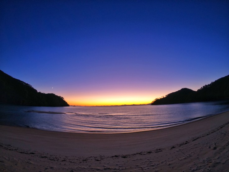
I woke around 5:30, due to first light starting to stream in through the cabin windows. I contemplated rolling over and going back to sleep but thought the temptation, instead, getting up and putting some clothes on to head out to the beach. The sun was yet to rise over the distant shoreline, the light was magnificent, the waves lapping at the shore and sea birds rose from their slumber. I sat there just taking it all in and snapped a few photos as the sun finally crept up and over the water to start the day. Although sunrise is certainly more effort normally than a sunset, I think this is one of the reasons as to why I prefer them, they require more determination to wake and get out of bed but upon doing so mother nature often rewards you in spades! After the perfect start to the day, I had some breakfast before commencing day two on the track. At Bark Bay, there is another tidal estuary that can only be crossed during low tide. At my time of departure, the tide was in so I had to take the short detour via the high tide track heading out towards Tonga Quarry with views of Tonga island, another beautiful beach and bay where again it was just myself and various sea birds. From here you head to Onetahuti Beach which is an extensive sweeping part of the coastline. You walk along the beach itself here as part of the track. Just as I was about to leave the beach behind and head back inland towards Awaroa a seal came into the shallows chasing fish for his morning breakfast just 10 m or so off-shore from where I was sat having a mid-morning snack. Across the whole 1 km expanse of beach, there was no one to be seen, just me and the seal. Pretty special.
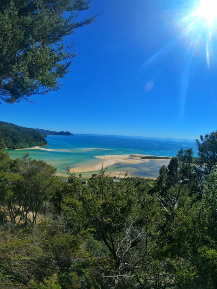
From here I made my way towards Awaroa itself and the 3rd and final tidal crossing of the hike. This one however is the only one where there is no high tide track so it is imperative to arrive and cross during low tide as if you miss the window that’s you done for the day. Low tide for me was around 2 pm giving me a 1.5-hour window on either side to cross. I arrived around 11:30 giving me ample time to have some lunch and wait for the waters to recede a little. I actually recommend arriving a bit before low tide if at all possible as this allows you to witness the inlet with beautiful cyan waters and white beaches. The view from the hilltop as I approached Awaroa was beautiful. It really reminded me of Whitehaven Beach in the Whitsundays, maybe not quite as grand but equally as beautiful. Once the water had receded enough I started to cross the estuary. It was still a good hour or more till official low tide so there was certainly still a good amount of water across my path. I was mainly up to my knees but at one point in one certain trench it did come up to my waist haha. Still was a nice way to cool off a little and certainly added a unique twist to the hike. After crossing the inlet it was the final push onwards to the golden sands of Totaranui beach.
My water taxi was due to collect me at 3:30 and I arrived with around 1 hour to spare, so just chilled out waiting for my ride. Like clockwork, my water taxi arrived and ferried me across some slight choppy seas back to Moharau where I caught a ride back to KT and Elgan’s cabin for the night. The hike was absolutely amazing though and up there with one of my highlights of NZ. The various beaches, bays, coves and estuaries were all stunning. At times I felt I had been transported back to the Philippines or Thailand. The water was also pristine and such an array of different shades of blue. The final cherry on top was how desolate the track was, normally this is the most popular Great Walk with some 250,000 people walking the track each year, which averages to around 600 a day. But given current circumstances, it was practically deserted. Every beach I had to myself. Picture-perfect beaches which would often have various groups of people dotted along due to the numbers on the track simply weren’t there. I was hiking in paradise and had it all to myself. It must have been in a similar state to how the land would have looked when dutch explorer Able Janszoon Tasman first landed in NZ and where the national park draws its name from. He was the first known European explorer to reach New Zealand, the islands of Fiji and Van Diemen’s Land (now Tasmania, Australia). He first anchored in Wharewharangi Bay, near Wainui Inlet to the north of what is now Abel Tasman National Park, on 18 December 1642 directly left of the Able Tasman Track. I love travelling and seeing new places, so I can’t imagine how unbelievable it must have been on these voyages discovering new worlds not previously known to those in the western world.
Part II of my time on the top of the South Island shall be published in the coming days 🙂

Lovely read Calum a coastal walk is definitely my preference with the sound of the sea in the background 😍. Lots of love Mum 💙😘💙
LikeLiked by 1 person
Yeah you would have liked it for sure 😊
LikeLike
Another lovely read wish I could have been their. Look forward to next part.love Nan xx
LikeLike